
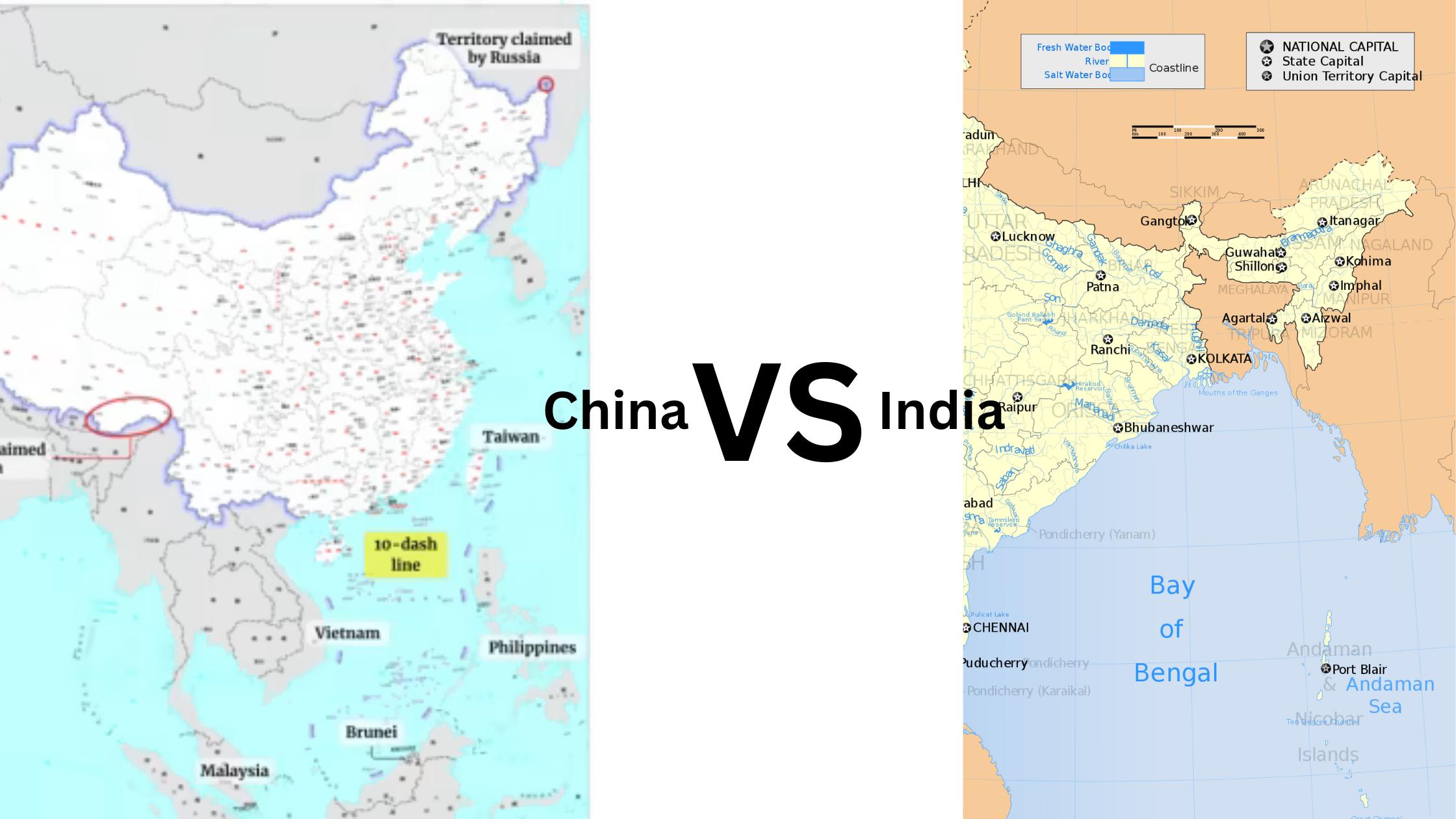
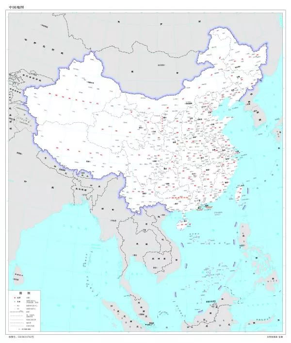
On August 28th 2023 (Monday), the 2023 edition of China map was launched on the website of the standard map service hosted by the Ministry of Natural Resources. This move by China has upset many countries in the Asia-Pacific region, leading to official objections that continue to mount.
But Why China’s New Map Controversial?
This map is the latest assertion of Chinese territorial claims that extend from the India’s Ladakh in the West to the South China Sea in the East and the whole of Taiwan, which China considers to be a breakaway province.
The countries who have voiced their opposition to this newly published map of China are as follows –
- India has raised strong objections against the map – As it claims parts of Indian territory India’s North Eastern State of Arunachal Pradesh and the disputed region Aksai Chin (a part of Ladakh), as its own.
- Philippines has raised strong objections against the map – As the map claims the disputed area under the ‘nine dash line’ as its own territory. This is in spite of the fact that in July 2016, the International Court of Arbitration passed a judgement in favor of Philippines and stated that Beijing’s territorial claims were not based on logical facts.
- Malaysia has rejected the new map – Because the Nine Dash line includes disputed waters in Sabah and Sarawak off the coast of Malaysian Borneo.
- Vietnam has denounced the map – As the map includes the Paracel and Spratly Island chains.
- Taiwan firmly objects the claims – As Taiwan (or Republic of China) has been outlined as a China’s territory.
“Taiwan, the Republic of China, is a sovereign and independent country and is not affiliated with the People’s Republic of China”
Taiwan’s Ministry of Foreign Affairs
Deep Dive into the history of Sino-Indian Border Disputes
The Sino-Indian border dispute has been an ongoing territorial dispute over the sovereignty of two relatively large and several smaller, separated pieces of territory between China and India.
First Issue – Aksai Chin
The Aksai Chin area is administered by China as part of the Xinjiang Uyghur Autonomous Region and Tibet Autonomous Region. But this land is also claimed by India as a part of the Union Territory of Ladakh. It is mostly uninhabited high-altitude wasteland in the larger regions of Kashmir and Tibet.
Second Issue – Arunachal Pradesh
The other disputed territory is south of the McMahon Line in the area now known as Arunachal Pradesh and administered by India. The McMahon Line is the boundary between Tibet and British India. The line is named after Henry McMahon, who was the foreign secretary of British India and the chief British negotiator of the conference at Shimla.
The Shimla Convention, officially known as the Convention between Great Britain, China, and Tibet was a treaty concerning the status of Tibet negotiated by representatives of the Republic of China, Tibet and Great Britain in Shimla in 1913 and 1914. The line delimited the respective spheres of influence of the two countries in the Eastern Himalayan region along Northeast India and Northern Burma which were earlier undefined. China (or People’s Republic of China, PRC) disowns the agreement stating that Tibet was never independent when it signed the Shimla Convention.
Multiple Conflicts & Agreements Between China & India Over Territorial Boundary
- In 1962 the Sino-Indian War was fought in both the disputed areas – The Chinese troops attacked the Indian border posts in Ladakh in the west and crossed the McMahon line in the east.
- Brief border clash in the region of Sikkim in 1967.
- Potential conflicts over the two differing Lines of Actual Control were successfully de-escalated in 1987 and 2013.
- A conflict involving a Bhutanese controlled area on the border of Bhutan and China was successfully de-escalated in 2017.
- Multiple brawls occurred in 2020, causing dozens of deaths.
Agreements that were signed pending the ultimate resolution of the boundary question were concluded in 1993 and 1996. This included the Confidence-building measures and the Line of Actual Control. To address the question of boundary formalized groups such as the Joint Working Group (JWG) were created. It was assisted by the Diplomatic and Military Expert Group. In 2003, the Special Representatives Mechanism was constituted. In 2012, another dispute resolution mechanism was framed- The Working Mechanism for Consultation and Coordination (WMCC).
India’s Response to the Newly Published China’s Map
India on Tuesday lodged a “strong protest” with China over the publication of the new map that showed all of Arunachal Pradesh, Aksai Chin, and other parts of Indian territory within its borders. External Affairs Minister S. Jaishankar called it “absurd claims”. The map published in the past also had claimed Indian territories.
Interestingly, this map was published just days after Prime Minister Narendra Modi met with Chinese President Xi Jinping and discussed resolving the boundary question. According to the Chinese State Media, the map was released during what is being called the “National Mapping Awareness Publicity Week ” in China which would be followed by other digital and navigational maps.
Another interesting development came after the meeting between Prime Minister Narendra Modi and President Xi Jinping that took place on at the Leaders Lounge on the 23rd August 2023 during the BRICS summit in Johannesburg. It was indicated that the two countries would seek to resolve the Line of Actual Control (LAC) military stand-off through talks – But, though India’s Ministry of External Affairs claimed that Mr. Modi and Mr. Xi had directed officials to resolve the LAC situation through “expeditious” disengagement and de-escalation; the Chinese Ministry of Foreign Affairs said that Mr. Xi had merely stressed upon the importance of improving relations (The Hindu, 2023).
China’s Possible Motive Behind the Release Of The New Map
President Xi Jinping’s goal of transforming China into a global superpower has led to an aggressive foreign policy and bold moves in key Asian flashpoints. In 2022, new legislation was passed by China to manage its border areas, emphasizing measures to promote national sovereignty. The 2023 map, released by the Chinese Ministry of Natural Resources, maintains China’s territorial claims on its western borders and underscores Beijing’s claims over Taiwan. Chinese Foreign spokesperson Wang Wenbin defends the map release as routine practice and hopes for an objective and rational response from relevant parties.
But what could be the possible motives for Xi Jinping’s government to take such a provocative step ?
Beijing’s recent announcement of “standardizing” the names of places in Arunachal Pradesh, India, is seen as a response to India’s activities leading up to the G-20 summit, which Beijing opposed.
The Chinese State Media indicates that the map was released during the “National Mapping Awareness Publicity Week,” coinciding with the 30-year anniversary of China’s Law of Surveying and Mapping. The Ministry of Natural Resources plans to release digital maps and navigation tools for various purposes, including location-based services and precision agriculture.
However, the release of the map just before the G-20 summit is seen as a contentious move by Beijing, showcasing its unwavering position on territorial claims. China’s aim is to assert its claims and ensure other countries in the region are aware of its positions.
Global Reaction to China’s New Controversial Map
The release of the new map by China could lead to significant implications between the two countries. It is likely to increase the tensions between India and China. S. Jaishankar, the External Affairs Minister said “Just making absurd claims does not make other people’s territories yours” while responding to the Chinese move.
The new map has also raised objections from the Philippines, Malaysia, Taiwan, and Vietnam.
While rejecting the new map released by China, the Philippines Foreign Affairs Department said that the map is the “latest attempt to legitimize China’s purported sovereignty and jurisdiction over Philippine features and maritime zones (and) has no basis under international law”.
Malaysia’s Ministry of Foreign Affairs has also dismissed China’s ‘unilateral claims’. It also stated that “It is consistent in its position of rejecting any foreign party’s claims to sovereignty, sovereign rights and jurisdiction on Malaysia’s maritime features”.
Taiwan’s Ministry of Foreign Affairs on Wednesday rebuked China’s new ‘standard map’ by saying Taiwan has never been ruled by the People’s Republic of China (PRC).
Vietnam has rejected the new map released by China and has said that the new map violates its sovereignty over the Spratly and Paracel Islands and jurisdiction over its waters.